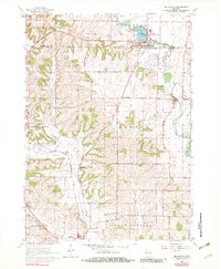
1962 Map of Belleville
USGS Topo · Published 1982About this map
Sugar River meanders through the central and eastern portions of this landscape, anchoring the village of Belleville and the settlement of Dayton. The geography is defined by a significant rail network, featuring the Illinois Central Gulf Railroad running north-south and the Chicago Milwaukee St Paul and Pacific line crossing the southwestern corner near Monticello.
Find a feature on this map
32 named features on this map. Tap any name to fly to it.
Don’t see what you’re looking for? This feature index may not catch every label — zoom into the map to look around manually.
Map Details
Editions of this 1962 Belleville Map
2 editions found
Other maps of this area

1889 · Evansville
USGS Topo · 1:62,500

1893 · Brodhead
USGS Topo · 1:62,500

1894 · Evansville
USGS Topo · 1:62,500

1906 · Evansville
USGS Topo · 1:62,500

1920 · Monroe
USGS Topo · 1:62,500

1922 · Monroe
USGS Topo · 1:62,500

1923 · New Glarus
USGS Topo · 1:62,500

1954 · Rockford
USGS Topo · 1:250,000

1955 · Rockford
USGS Topo · 1:250,000

1958 · Rockford
USGS Topo · 1:250,000