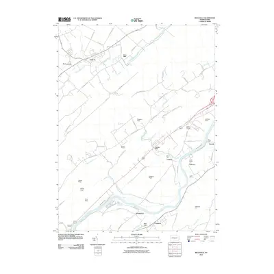
2010 Map of Belleville
USGS Topo · Published 2010About this map
Kishacoquillas Creek and the Juniata River define the settlement patterns of this Mifflin County landscape, where agriculture and early industrial remnants sit side-by-side. The communities of Belleville and Mechanicsville anchor the northern reaches, while the southern corridor follows the historical path of the Pennsylvania Canal through Lockport and Granville. This survey preserves the location of several aviation landmarks, including Lewistown Airport, Bratton Airport, and Cargill Airport, highlighting the region's connectivity. Between the prominent ridges of Front Mountain and Chestnut Ridge, the land is dotted with family-named sites and rural centers like Strodes Mills and Union Mills. Researchers can trace the lineage of the valley through sites like Juniata Memorial Cemetery and the Corbin Cemetery, situated near the river's bend at Anderson.
Find a feature on this map
77 named features on this map. Tap any name to fly to it.
Don’t see what you’re looking for? This feature index may not catch every label — zoom into the map to look around manually.
Map Details
Editions of this 2010 Belleville Map
This is the sole edition of this map. No revisions or reprints were ever made.
Other maps of this area

1919 · Mattawana
USGS Topo · 1:62,500

1919 · Menno
USGS Topo · 1:62,500

1922 · Mt Union
USGS Topo · 1:48,000

1924 · Mt. Union
USGS Topo · 1:62,500

1924 · Lewistown
USGS Topo · 1:62,500

1927 · Lewisburg
USGS Topo · 1:62,500

1935 · Allensville
USGS Topo · 1:62,500

1936 · East Waterford
USGS Topo · 1:48,000

1938 · Allensville
USGS Topo · 1:62,500

1941 · East Waterford
USGS Topo · 1:62,500
Featured Places
- Granville Township, PA
- Menno Township, PA
- Bratton Township, PA
- Horningford, Bratton Township
- Strodes Mills, Granville Township