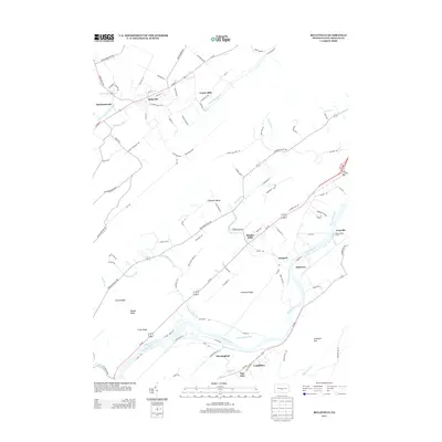
2013 Map of Belleville
USGS Topo · Published 2013About this map
Belleville and the neighboring settlements of Mechanicsville and Union Mills anchor the northern landscape of this Mifflin County study, where the waters of Kishacoquillas Cr flow through the valley floor. The map highlights a significant transportation corridor to the south, where the Juniata River runs parallel to the historic remnants of the Pennsylvania Canal. This area is defined by its series of prominent ridges, including Church Ridge, Chestnut Ridge, and Front Ridge, which channel local development and road networks like Ferguson Valley Rd into the lowlands.
Find a feature on this map
101 named features on this map. Tap any name to fly to it.
Don’t see what you’re looking for? This feature index may not catch every label — zoom into the map to look around manually.
Map Details
Editions of this 2013 Belleville Map
This is the sole edition of this map. No revisions or reprints were ever made.
Other maps of this area

1919 · Mattawana
USGS Topo · 1:62,500

1919 · Menno
USGS Topo · 1:62,500

1922 · Mt Union
USGS Topo · 1:48,000

1924 · Mt. Union
USGS Topo · 1:62,500

1924 · Lewistown
USGS Topo · 1:62,500

1927 · Lewisburg
USGS Topo · 1:62,500

1935 · Allensville
USGS Topo · 1:62,500

1936 · East Waterford
USGS Topo · 1:48,000

1938 · Allensville
USGS Topo · 1:62,500

1941 · East Waterford
USGS Topo · 1:62,500
Featured Places
- Granville Township, PA
- Menno Township, PA
- Bratton Township, PA
- Horningford, Bratton Township
- Strodes Mills, Granville Township