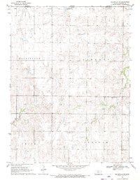
1968 Map of Belleville NW
USGS Topo · Published 1971About this map
Rose Creek and West Creek carve through the agricultural landscape of northern Republic County, just south of the Nebraska border. This 1968 survey documents a rural environment organized into distinct civil townships, including Washington, Liberty, Union, and Freedom. The map is particularly useful for genealogical research, identifying the precise locations of several community burial grounds such as Liberty Cem, Stephenson Cem, and St Josaphats Cem. The pattern of section lines and fence rows reflects the enduring homesteading heritage of the Great Plains. Water management and drainage are central to the landscape, with numerous small farm ponds and drainage basins supporting the upland farms between the creek valleys. The interface between Thayer Co and Republic Co along the northern edge marks the transition from Kansas into Nebraska.
Find a feature on this map
10 named features on this map. Tap any name to fly to it.
Don’t see what you’re looking for? This feature index may not catch every label — zoom into the map to look around manually.
Map Details
Editions of this 1968 Belleville NW Map
This is the sole edition of this map. No revisions or reprints were ever made.
Other maps of this area

1892 · Concordia
USGS Topo · 1:125,000

1898 · Hebron
USGS Topo · 1:125,000

1955 · Manhattan
USGS Topo · 1:250,000

1955 · Lincoln
USGS Topo · 1:250,000

1956 · Manhattan
USGS Topo · 1:250,000

1957 · Manhattan
USGS Topo · 1:250,000

1957 · Lincoln
USGS Topo · 1:250,000

1958 · Lincoln
USGS Topo · 1:250,000

1960 · Byron
USGS Topo · 1:24,000

1960 · Chester
USGS Topo · 1:24,000