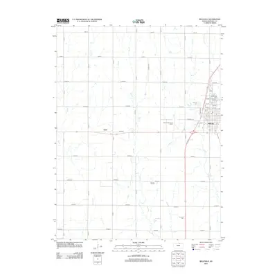
2012 Map of Belleville
USGS Topo · Published 2012About this map
Belleville serves as the focal point of this Republic County landscape, centered on its orderly street grid and the North Central Kansas Free Fair grounds. The town's layout is meticulously detailed, showing the Belleville High campus and the central Po (Post Office) near 14th St. Surrounding the urban center, the geography transitions into a vast agricultural grid defined by numbered county roads and natural drainage systems like West Cr and Riley Cr.
Find a feature on this map
38 named features on this map. Tap any name to fly to it.
Don’t see what you’re looking for? This feature index may not catch every label — zoom into the map to look around manually.
Map Details
Editions of this 2012 Belleville Map
This is the sole edition of this map. No revisions or reprints were ever made.
Other maps of this area

1892 · Concordia
USGS Topo · 1:125,000

1955 · Manhattan
USGS Topo · 1:250,000

1956 · Manhattan
USGS Topo · 1:250,000

1957 · Manhattan
USGS Topo · 1:250,000

1965 · Wayne
USGS Topo · 1:24,000

1965 · Concordia NW
USGS Topo · 1:24,000

1965 · Kackley
USGS Topo · 1:24,000

1966 · Scandia
USGS Topo · 1:24,000
1966 · Belleville SE
USGS Topo · 1:24,000
1966 · Belleville
USGS Topo · 1:24,000