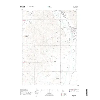
2020 Map of Bellevue
USGS Topo · Published 2020About this map
The Big Wood River serves as the central artery for this portion of the Wood River Valley, dictating the settlement patterns of Hailey and Bellevue. To the west of these towns, the terrain rises into a series of named gulches and ridges that reflect the region's mining and ranching heritage, including Minnie Moore Gulch and Croesus Gulch. A complex network of irrigation infrastructure is evident, with the Hiawatha Canal, Cove Canal, and Bypass Canal channeling water across the landscape toward agricultural sites like Poverty Flat.
Find a feature on this map
84 named features on this map. Tap any name to fly to it.
Don’t see what you’re looking for? This feature index may not catch every label — zoom into the map to look around manually.
Map Details
Editions of this 2020 Bellevue Map
This is the sole edition of this map. No revisions or reprints were ever made.
Other maps of this area

1895 · Hailey
USGS Topo · 1:125,000

1897 · Hailey
USGS Topo · 1:125,000

1955 · Hailey
USGS Topo · 1:250,000

1957 · Bellevue
USGS Topo · 1:62,500

1957 · Bellevue
USGS Topo · 1:24,000

1959 · Hailey
USGS Topo · 1:250,000

1962 · Hailey
USGS Topo · 1:250,000

1967 · Baugh Creek SW
USGS Topo · 1:24,000

1967 · Mahoney Butte
USGS Topo · 1:24,000

1967 · Hailey
USGS Topo · 1:24,000