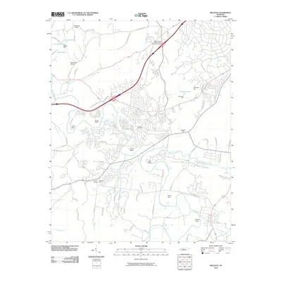
2010 Map of Bellevue
USGS Topo · Published 2010About this map
The Harpeth River meanders through this landscape west of Nashville, defining a series of sharp alluvial turns including Hows Bend, Hutton Bend, and Beech Bend. By the early 21st century, suburban development had expanded across the corridor between the river and Ninemile Hill, centered on the Bellevue Post Office and intersections like Vaughns Gap.
Find a feature on this map
76 named features on this map. Tap any name to fly to it.
Don’t see what you’re looking for? This feature index may not catch every label — zoom into the map to look around manually.
Map Details
Editions of this 2010 Bellevue Map
This is the sole edition of this map. No revisions or reprints were ever made.
Other maps of this area

1901 · Colombia
USGS Topo · 1:125,000

1903 · Nashville
USGS Topo · 1:125,000

1909 · Franklin
USGS Topo · 1:62,500

1930 · White Bluff
USGS Topo · 1:62,500

1932 · Nashville
USGS Topo · 1:62,500

1933 · White Bluff
USGS Topo · 1:62,500

1946 · Leipers Fork
USGS Topo · 1:24,000

1949 · Leipers Fork
USGS Topo · 1:24,000

1949 · Franklin
USGS Topo · 1:24,000

1951 · Fairview
USGS Topo · 1:24,000