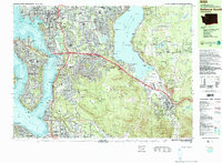
1983 Map of Bellevue South
USGS Topo · Published 1983About this map
Bellevue and its southeastern neighbors are captured during a period of significant suburban expansion and infrastructure development in the early 1980s. The landscape is defined by the corridors of Interstate 90 and Interstate 405, which cut through established and emerging neighborhoods like Woodridge, Factoria, and Newport Hills. Between the deep waters of Lake Washington and Lake Sammamish, the map reveals a transition from dense urban centers to the steep, wooded heights of Cougar Mountain and the Newcastle Hills.
Find a feature on this map
102 named features on this map. Tap any name to fly to it.
Don’t see what you’re looking for? This feature index may not catch every label — zoom into the map to look around manually.
Map Details
Editions of this 1983 Bellevue South Map
This is the sole edition of this map. No revisions or reprints were ever made.
Other maps of this area

1894 · Seattle
USGS Topo · 1:62,500

1895 · Snohomish
USGS Topo · 1:125,000

1897 · Tacoma
USGS Topo · 1:125,000

1897 · Seattle
USGS Topo · 1:125,000

1900 · Tacoma
USGS Topo · 1:125,000

1908 · Seattle
USGS Topo · 1:62,500

1909 · Seattle Special
USGS Topo · 1:62,500

1913 · Cedar Lake
USGS Topo · 1:125,000

1921 · Sultan
USGS Topo · 1:125,000

1923 · Sultan
USGS Topo · 1:125,000