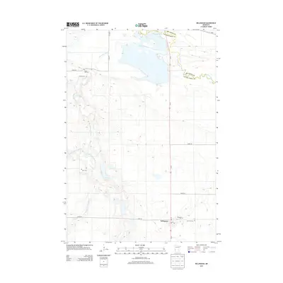
2013 Map of Bellingham
USGS Topo · Published 2013About this map
Bellingham anchors this corner of the Minnesota prairie, situated at the intersection of Us-75 and Co HWY-30. The landscape is defined by the winding course of the Yellow Bank River and its S Fork, which cut through the agricultural grid toward the Minnesota River at the boundary between Big Stone and Lac qui Parle counties. The distribution of small rural burial grounds, including Yellow Bank Cem, Immanuel Cem, and Salem Cem, indicates the footprint of early family and congregational settlement in the township. Near the town center, researchers can find the Post Office and the neighboring Bellingham Cem and Saint Pauls Cem, providing a clear view of the community's local center of gravity during this period.
Find a feature on this map
23 named features on this map. Tap any name to fly to it.
Don’t see what you’re looking for? This feature index may not catch every label — zoom into the map to look around manually.
Map Details
Editions of this 2013 Bellingham Map
This is the sole edition of this map. No revisions or reprints were ever made.
Other maps of this area

1953 · Ortonville
USGS Topo · 1:62,500

1953 · Bellingham
USGS Topo · 1:62,500

1953 · Milbank
USGS Topo · 1:250,000

1958 · Milbank
USGS Topo · 1:250,000

1958 · Madison
USGS Topo · 1:24,000

1958 · Correll
USGS Topo · 1:24,000

1968 · Artichoke Lake
USGS Topo · 1:24,000

1971 · Odessa
USGS Topo · 1:24,000

1971 · Marietta
USGS Topo · 1:24,000
1971 · Haydenville
USGS Topo · 1:24,000