
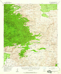
1957 Map of Bellota Ranch
USGS Topo · Published 1958About this map
Mining operations and remote cattle ranches define this mid-century portrait of the Santa Catalina Mts northeast of Tucson. The landscape is dotted with industrial history, from the Hartman Mine Group and Geesaman Mine Group near Marble Peak to the isolated Stratton Mine. These operations, along with timber and grazing interests, are served by a network of steep jeep trails and primitive roads like the Verde Rd.
Find a feature on this map
134 named features on this map. Tap any name to fly to it.
Don’t see what you’re looking for? This feature index may not catch every label — zoom into the map to look around manually.
Map Details
Editions of this 1957 Bellota Ranch Map
4 editions found
Other maps of this area

1904 · Tucson
USGS Topo · 1:125,000

1905 · Tucson
USGS Topo · 1:125,000

1911 · Winkelman
USGS Topo · 1:125,000

1913 · Winkelman
USGS Topo · 1:125,000

1938 · Galiuro Mts
USGS Topo · 1:48,000

1943 · Galiuro Mts
USGS Topo · 1:62,500

1945 · Redington
USGS Topo · 1:62,500

1945 · Happy Valley
USGS Topo · 1:62,500

1948 · Tucson
USGS Topo · 1:62,500

1948 · Mammoth
USGS Topo · 1:62,500