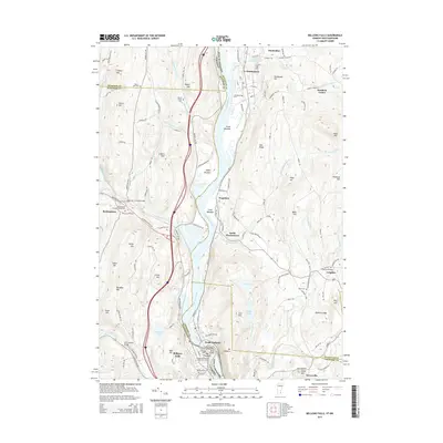
2015 Map of Bellows Falls
USGS Topo · Published 2015About this map
The Connecticut River serves as the central artery and state boundary in this 2015 survey, separating the riverfront villages of Bellows Falls and North Walpole. The landscape is defined by the tight corridor where the Williams River and Saxtons River meet the primary waterway, creating fertile grounds like Great Meadow and Upper Meadow. This area retains significant architectural heritage, evidenced by the Worrall Covered Bridge and the Hall Covered Bridge, which reflect the region's historic transportation engineering.
Find a feature on this map
132 named features on this map. Tap any name to fly to it.
Don’t see what you’re looking for? This feature index may not catch every label — zoom into the map to look around manually.
Map Details
Editions of this 2015 Bellows Falls Map
This is the sole edition of this map. No revisions or reprints were ever made.
Other maps of this area

1926 · Claremont
USGS Topo · 1:62,500

1927 · Bellows Falls
USGS Topo · 1:48,000

1928 · Ludlow
USGS Topo · 1:48,000

1929 · Claremont
USGS Topo · 1:62,500

1929 · Ludlow
USGS Topo · 1:62,500

1930 · Saxtons River
USGS Topo · 1:48,000

1930 · Bellows Falls
USGS Topo · 1:62,500

1932 · Ludlow
USGS Topo · 1:62,500

1933 · Saxtons River
USGS Topo · 1:62,500

1950 · Glens Falls
USGS Topo · 1:250,000