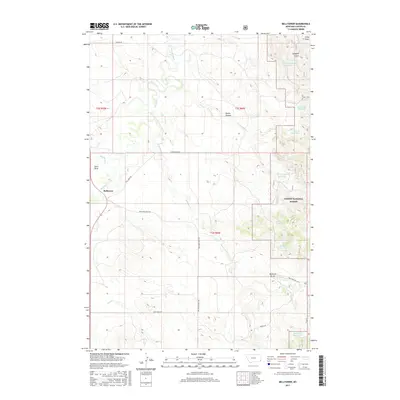
2017 Map of Belltower
USGS Topo · Published 2017About this map
Belltower serves as the central point of reference in this landscape of the eastern Montana rangelands, where water management is the primary driver of human geography. The area is defined by an extensive system of catchments and stock ponds designed to support cattle in a semi-arid environment. Named reservoirs such as Lampkin Gulch Reservoir, Horse Killer Reservoir, and Maverick Reservoir are scattered across the terrain, indicating a long history of ranching operations.
Find a feature on this map
30 named features on this map. Tap any name to fly to it.
Don’t see what you’re looking for? This feature index may not catch every label — zoom into the map to look around manually.
Map Details
Editions of this 2017 Belltower Map
This is the sole edition of this map. No revisions or reprints were ever made.
Other maps of this area

1954 · Ekalaka
USGS Topo · 1:250,000

1956 · Ekalaka
USGS Topo · 1:250,000

1958 · Ekalaka
USGS Topo · 1:250,000

1965 · Ekalaka
USGS Topo · 1:250,000

1980 · Taylor Hills
USGS Topo · 1:24,000

1980 · Belltower
USGS Topo · 1:24,000
1980 · Rustler Divide
USGS Topo · 1:24,000

1980 · Belltower Butte
USGS Topo · 1:24,000

1980 · Camp Needmore
USGS Topo · 1:24,000
1980 · School Section Creek
USGS Topo · 1:24,000