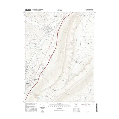
2016 Map of Bellwood
USGS Topo · Published 2016About this map
Logan Valley serves as a primary corridor for transportation and settlement in Blair County, defined by the winding course of the Little Juniata River and the Norfolk Southern rail line. The borough of Bellwood stands at the center of this landscape, surrounded by smaller communities like Fostoria, Roots, and Pinecroft. The map captures the transition from the valley floor to the prominent ridge of Brush Mtn, part of the larger Allegheny Mountains chain. Significant local history markers include Logan Valley Cem and Antis Cem, which provide valuable data points for genealogists. The southern portion of the sheet reaches the outskirts of Altoona, including East Altoona and Greenwood, where the terrain begins to rise toward Kettle Reservoir. This topographic study highlights the persistent relationship between the river, the railroad, and the valley settlements that grew alongside them.
Find a feature on this map
125 named features on this map. Tap any name to fly to it.
Don’t see what you’re looking for? This feature index may not catch every label — zoom into the map to look around manually.
Map Details
Editions of this 2016 Bellwood Map
This is the sole edition of this map. No revisions or reprints were ever made.
Other maps of this area

1901 · Huntingdon
USGS Topo · 1:62,500

1902 · Hollidaysburg
USGS Topo · 1:62,500

1903 · Hollidaysburg
USGS Topo · 1:62,500

1904 · Huntingdon
USGS Topo · 1:62,500

1920 · Altoona
USGS Topo · 1:62,500

1922 · Altoona
USGS Topo · 1:62,500

1923 · Tyrone
USGS Topo · 1:62,500

1929 · Tyrone
USGS Topo · 1:48,000

1933 · Tyrone
USGS Topo · 1:62,500

1946 · Tyrone
USGS Topo · 1:62,500