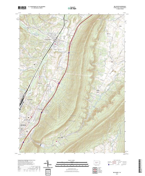
2023 Map of Bellwood
USGS Topo · Published 2023About this map
Logan Valley serves as a primary corridor for settlement and transit, where the Little Juniata River flows alongside communities like Bellwood and Roots. The landscape is sharply defined by the massive ridge of Brush Mountain, which separates the more industrialized Altoona outskirts from the agricultural expanse of Sinking Valley. This 2023 survey provides a clear look at how residential development in Greenwood and Pinecroft has expanded against the steep western slopes of the Allegheny Mountains.
Find a feature on this map
118 named features on this map. Tap any name to fly to it.
Don’t see what you’re looking for? This feature index may not catch every label — zoom into the map to look around manually.
Map Details
Editions of this 2023 Bellwood Map
This is the sole edition of this map. No revisions or reprints were ever made.
Other maps of this area

1901 · Huntingdon
USGS Topo · 1:62,500

1902 · Hollidaysburg
USGS Topo · 1:62,500

1903 · Hollidaysburg
USGS Topo · 1:62,500

1904 · Huntingdon
USGS Topo · 1:62,500

1920 · Altoona
USGS Topo · 1:62,500

1922 · Altoona
USGS Topo · 1:62,500

1923 · Tyrone
USGS Topo · 1:62,500

1929 · Tyrone
USGS Topo · 1:48,000

1933 · Tyrone
USGS Topo · 1:62,500

1946 · Tyrone
USGS Topo · 1:62,500