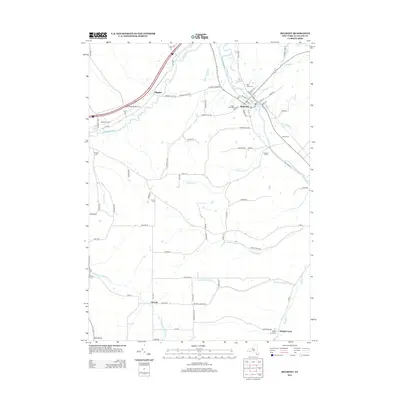
2013 Map of Belmont
USGS Topo · Published 2013About this map
The Genesee River carves through this northern Allegany County landscape, anchoring the village of Belmont. This region is defined by a dense concentration of rural burial grounds, including Forest Hills Cem, Saint Marys Cem, and Maple Grove Cem, which provide significant points of interest for genealogical research in the area. Smaller hamlets and named locales like Higgins, Inavale, and Knight Creek are scattered throughout the valley, connected by a network of drainage systems such as Van Campen Cr and Phillips Cr. The village layout of Belmont is particularly detailed, showing the street grid near the local Post Office and the convergence of local roads. Moving south and west, the map transitions into more isolated farmland and creek-side settlements like East Notch, where Snowball Hollow Cr and Gordon Brook intersect the agricultural terrain.
Find a feature on this map
83 named features on this map. Tap any name to fly to it.
Don’t see what you’re looking for? This feature index may not catch every label — zoom into the map to look around manually.
Map Details
Editions of this 2013 Belmont Map
This is the sole edition of this map. No revisions or reprints were ever made.
Other maps of this area

1906 · Angelica
USGS Topo · 1:62,500

1916 · Canaseraga
USGS Topo · 1:62,500

1925 · Belmont
USGS Topo · 1:62,500

1926 · Wellsville
USGS Topo · 1:62,500

1939 · Belmont
USGS Topo · 1:62,500

1940 · Canaseraga
USGS Topo · 1:62,500

1941 · Angelica
USGS Topo · 1:62,500

1950 · Elmira
USGS Topo · 1:250,000

1958 · Elmira
USGS Topo · 1:250,000

1960 · Buffalo
USGS Topo · 1:250,000