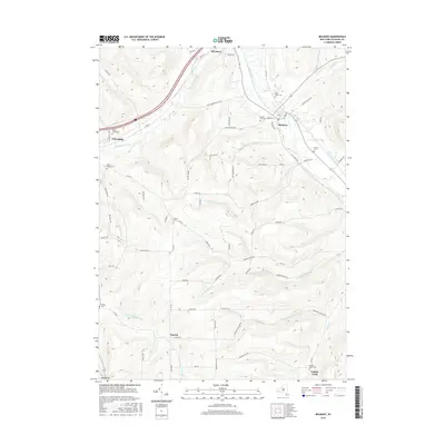
2016 Map of Belmont
USGS Topo · Published 2016About this map
The Genesee River cuts a wide valley through this portion of Allegany County, providing the primary corridor for the village of Belmont and the smaller community of Belvidere. The landscape is defined by its deep drainages and high ridges, including Corbin Hill and Middaugh Hill, where local roads trace the topography. Settlement patterns follow the water, with the village of Friendship established along Van Campen Creek to the west.
Find a feature on this map
75 named features on this map. Tap any name to fly to it.
Don’t see what you’re looking for? This feature index may not catch every label — zoom into the map to look around manually.
Map Details
Editions of this 2016 Belmont Map
This is the sole edition of this map. No revisions or reprints were ever made.
Other maps of this area

1906 · Angelica
USGS Topo · 1:62,500

1916 · Canaseraga
USGS Topo · 1:62,500

1925 · Belmont
USGS Topo · 1:62,500

1926 · Wellsville
USGS Topo · 1:62,500

1939 · Belmont
USGS Topo · 1:62,500

1940 · Canaseraga
USGS Topo · 1:62,500

1941 · Angelica
USGS Topo · 1:62,500

1950 · Elmira
USGS Topo · 1:250,000

1958 · Elmira
USGS Topo · 1:250,000

1960 · Buffalo
USGS Topo · 1:250,000