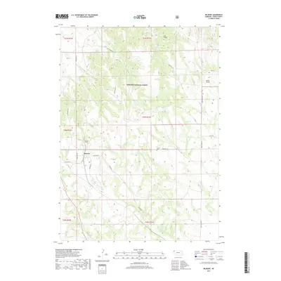
2017 Map of Belmont
USGS Topo · Published 2017About this map
Belmont stands as a focal point in this Dawes County landscape, situated where the high plains meet the intricate drainages of the Nebraska National Forest. The geography is defined by a network of named ridges and canyons, including the prominent Squaw Mound and Rock Canyon. Local water sources such as Dooley Spring and White Clay Cr have historically shaped the settlement patterns and land use in this part of the Nebraska panhandle.
Find a feature on this map
29 named features on this map. Tap any name to fly to it.
Don’t see what you’re looking for? This feature index may not catch every label — zoom into the map to look around manually.
Map Details
Editions of this 2017 Belmont Map
This is the sole edition of this map. No revisions or reprints were ever made.
Other maps of this area

1946 · Box Butte Reservoir West
USGS Topo · 1:24,000

1948 · Box Butte Reservoir West
USGS Topo · 1:24,000

1951 · Marsland
USGS Topo · 1:62,500

1955 · Alliance
USGS Topo · 1:250,000

1957 · Alliance
USGS Topo · 1:250,000

1958 · Alliance
USGS Topo · 1:250,000

1980 · Crow Butte
USGS Topo · 1:24,000
1980 · Coffee Mill Butte SW
USGS Topo · 1:24,000

1980 · Dead Mans Creek
USGS Topo · 1:24,000
1980 · Chimney Butte
USGS Topo · 1:24,000