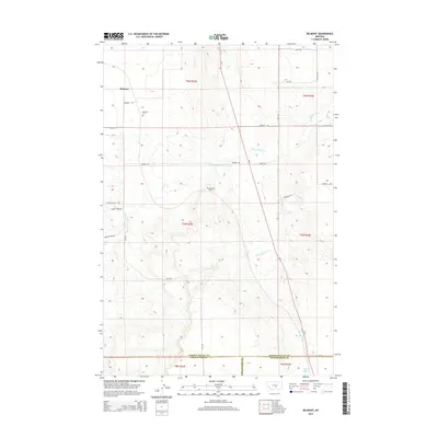
2014 Map of Belmont
USGS Topo · Published 2014About this map
Belmont serves as the primary focal point of this northern Montana landscape, situated near the intersection of Belmont Rd and Cushman Rd. The terrain is defined by a network of seasonal watercourses and drainage features, most notably Painted Robe Cr and its associated Painted Robe Tunnel. For genealogists and local historians, the Belmont Cem provides a specific point of reference within the township of T6N R22E. The southern portion of the map traces the intersection of three counties where Golden Valley, Stillwater, and Yellowstone meet. This transition from the central coulees toward Cottonwood Cr and the distant Alkali Pond illustrates the vast, open character of the region as it was surveyed in the early 21st century, dominated by ranching roads like Granary Rd and Utopia Rd.
Find a feature on this map
32 named features on this map. Tap any name to fly to it.
Don’t see what you’re looking for? This feature index may not catch every label — zoom into the map to look around manually.
Map Details
Editions of this 2014 Belmont Map
This is the sole edition of this map. No revisions or reprints were ever made.
Other maps of this area

1889 · Big Snowy Mountain
USGS Topo · 1:250,000

1893 · Big Snowy Mountain
USGS Topo · 1:250,000

1954 · Roundup
USGS Topo · 1:250,000

1958 · Roundup
USGS Topo · 1:250,000

1979 · Roundup
USGS Topo · 1:100,000

1979 · Bundy
USGS Topo · 1:24,000

1979 · Lavina
USGS Topo · 1:24,000

1979 · Belmont
USGS Topo · 1:24,000
1979 · Broadview East
USGS Topo · 1:24,000
1980 · Broadview West
USGS Topo · 1:24,000