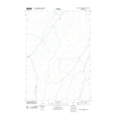
2011 Map of Belmont Park Ranch
USGS Topo · Published 2011About this map
Sweetwater Creek and its various tributaries define the drainage patterns of this high-elevation Madison County landscape. In the northern reaches, the Belmont Park Ranch sits near the intersection of Stone Creek Rd and the creek's upper waters. The terrain is marked by a sparse network of ranching outposts and camps connected by unimproved roads, reflecting the large-scale land use of the region in the early twenty-first century. To the southwest, Fries Place occupies a position near where Spring Brook begins its descent, while the southern extent of the map includes Spring Brook Camp along Honeymoon Springs Rd. On the eastern side of the quadrangle, the headwaters of Robb Creek and the associated Robb Creek Rd provide the primary access through this remote portion of the Montana backcountry.
Find a feature on this map
9 named features on this map. Tap any name to fly to it.
Don’t see what you’re looking for? This feature index may not catch every label — zoom into the map to look around manually.
Map Details
Editions of this 2011 Belmont Park Ranch Map
This is the sole edition of this map. No revisions or reprints were ever made.
Other maps of this area

1893 · Dillon
USGS Topo · 1:250,000

1955 · Dubois
USGS Topo · 1:250,000

1955 · Dillon
USGS Topo · 1:250,000

1957 · Dillon
USGS Topo · 1:250,000

1958 · Dubois
USGS Topo · 1:250,000

1958 · Dillon
USGS Topo · 1:250,000

1961 · Mine Gulch
USGS Topo · 1:24,000

1961 · Red Canyon
USGS Topo · 1:24,000

1962 · Dillon
USGS Topo · 1:250,000
1963 · Metzel Ranch
USGS Topo · 1:24,000