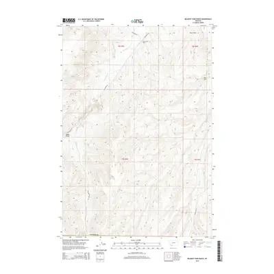
2014 Map of Belmont Park Ranch
USGS Topo · Published 2014About this map
Belmont Park Ranch and the isolated settlement of Fries Place anchor this 2014 survey of Madison County's high-altitude grazing lands. The landscape is defined by a series of drainage networks and springs that have long supported cattle ranching in the region. Principal water sources including Sweetwater Cr, Spring Brook, and Robb Cr cut through the terrain, flanked by notable geographic features like Peschi Draw and Hale Draw. The map documents a sparsely populated but active ranching environment, where connectivity is maintained through rural routes such as Sweetwater Rd and Robb Creek Rd. Notable landmarks like Honeymoon Springs provide specific points of interest for those tracking land use and historic water rights in this part of Montana.
Find a feature on this map
15 named features on this map. Tap any name to fly to it.
Don’t see what you’re looking for? This feature index may not catch every label — zoom into the map to look around manually.
Map Details
Editions of this 2014 Belmont Park Ranch Map
This is the sole edition of this map. No revisions or reprints were ever made.
Other maps of this area

1893 · Dillon
USGS Topo · 1:250,000

1955 · Dubois
USGS Topo · 1:250,000

1955 · Dillon
USGS Topo · 1:250,000

1957 · Dillon
USGS Topo · 1:250,000

1958 · Dubois
USGS Topo · 1:250,000

1958 · Dillon
USGS Topo · 1:250,000

1961 · Mine Gulch
USGS Topo · 1:24,000

1961 · Red Canyon
USGS Topo · 1:24,000

1962 · Dillon
USGS Topo · 1:250,000
1963 · Metzel Ranch
USGS Topo · 1:24,000