
2017 Map of Belmont Park Ranch
USGS Topo · Published 2017About this map
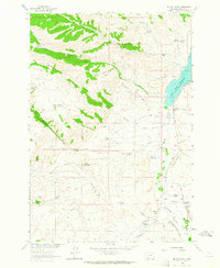
Belmont Park Ranch occupies the northern reaches of this high-elevation landscape in Madison County, where the terrain is defined by complex drainage networks and intermittent water sources. The map traces the winding course of Sweetwater Cr as it flows near the ranch, while further south, the appropriately named Honeymoon Springs emerges at the head of a drainage basin. This area represents a classic Montana ranching environment, where the geography of the land dictates the placement of roads and homesteads.
Find a feature on this map
15 named features on this map. Tap any name to fly to it.
Don’t see what you’re looking for? This feature index may not catch every label — zoom into the map to look around manually.
Map Details
Editions of this 2017 Belmont Park Ranch Map
This is the sole edition of this map. No revisions or reprints were ever made.
Other maps of this area

1893 · Dillon
USGS Topo · 1:250,000

1955 · Dubois
USGS Topo · 1:250,000

1955 · Dillon
USGS Topo · 1:250,000

1957 · Dillon
USGS Topo · 1:250,000

1958 · Dubois
USGS Topo · 1:250,000

1958 · Dillon
USGS Topo · 1:250,000

1961 · Mine Gulch
USGS Topo · 1:24,000

1961 · Red Canyon
USGS Topo · 1:24,000

1962 · Dillon
USGS Topo · 1:250,000
1963 · Metzel Ranch
USGS Topo · 1:24,000