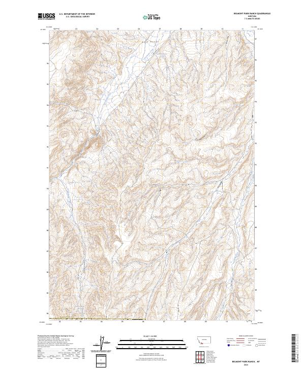
2024 Map of Belmont Park Ranch
USGS Topo · Published 2024About this map
The Ruby Range dominates this portion of Madison County, defining a landscape where seasonal drainages and permanent springs dictate the movement of ranching and travel. Water is the primary driver of geography here, with Honeymoon Springs and named points like 08S05W26BADA01 Spring providing essential resources in an otherwise arid basin. The drainage network is clearly defined by Sweetwater Creek and Robb Creek, which are shadowed by a sparse road system including Sweetwater Rd and Robb Creek Rd.
Find a feature on this map
18 named features on this map. Tap any name to fly to it.
Don’t see what you’re looking for? This feature index may not catch every label — zoom into the map to look around manually.
Map Details
Editions of this 2024 Belmont Park Ranch Map
This is the sole edition of this map. No revisions or reprints were ever made.
Other maps of this area

1893 · Dillon
USGS Topo · 1:250,000

1955 · Dubois
USGS Topo · 1:250,000

1955 · Dillon
USGS Topo · 1:250,000

1957 · Dillon
USGS Topo · 1:250,000

1958 · Dubois
USGS Topo · 1:250,000

1958 · Dillon
USGS Topo · 1:250,000

1961 · Mine Gulch
USGS Topo · 1:24,000

1961 · Red Canyon
USGS Topo · 1:24,000

1962 · Dillon
USGS Topo · 1:250,000
1963 · Metzel Ranch
USGS Topo · 1:24,000