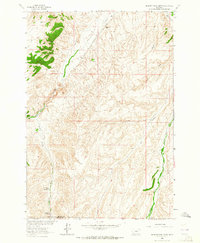
1963 Map of Belmont Park Ranch
USGS Topo · Published 1965About this map
Belmont Park Ranch sits at the heart of this high-elevation landscape along the border of Madison and Beaverhead Counties. Published in the mid-1960s, the map documents a quiet period of pastoral use where cattle operations relied on a network of natural water sources like Honeymoon Springs and Spring Brook Spring. The terrain is defined by deep incisions such as Dry Hollow and Peschi Draw, which transition into the broader drainage of Sweetwater Creek. This sheet highlights the isolation of mid-century Montana ranching life, where connectivity was limited to the Sweetwater Road and a sparse network of secondary routes. Small residential outposts like Fries Place are noted, providing specific locations for genealogists tracing family land holdings in this high country before more modern consolidation changed the ranching landscape.
Find a feature on this map
13 named features on this map. Tap any name to fly to it.
Don’t see what you’re looking for? This feature index may not catch every label — zoom into the map to look around manually.
Map Details
Editions of this 1963 Belmont Park Ranch Map
This is the sole edition of this map. No revisions or reprints were ever made.
Other maps of this area

1893 · Dillon
USGS Topo · 1:250,000

1955 · Dubois
USGS Topo · 1:250,000

1955 · Dillon
USGS Topo · 1:250,000

1957 · Dillon
USGS Topo · 1:250,000

1958 · Dubois
USGS Topo · 1:250,000

1958 · Dillon
USGS Topo · 1:250,000

1961 · Mine Gulch
USGS Topo · 1:24,000

1961 · Red Canyon
USGS Topo · 1:24,000

1962 · Dillon
USGS Topo · 1:250,000
1963 · Metzel Ranch
USGS Topo · 1:24,000