2023 Map of Belmont
USGS Topo · Published 2023About this map
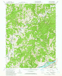
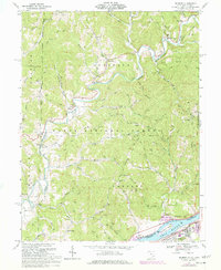
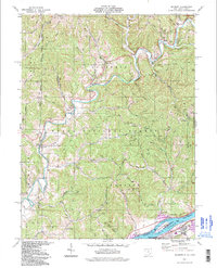
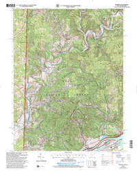
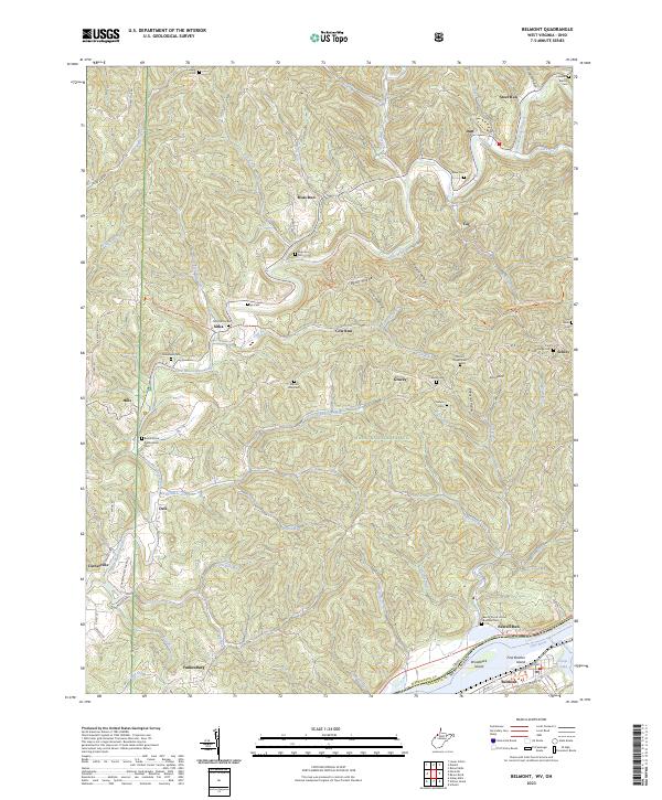
The Little Muskingum River meanders through a landscape defined by deep ridges and hollows, connecting small communities such as Dart, Fay, and Gracey. This area, heavily forested within the Wayne National Forest, shows a pattern of dispersed settlement and small cemeteries that speak to the local genealogy and heritage of Washington County. Family-named landmarks like Ludwig Cem and Rake Cem are scattered along the hillsides of Bean Ridge and Pine Ridge, while larger valley settlements like Belmont and Newell Run anchor the southern edge of the survey near the Ohio River Islands National Wildlife Refuge. The map details the transition from the river bottomlands, featuring Broadback Island and First Brother Island, to the upland drainages of Eightmile Creek and Cow Run, reflecting a rural Ohio River Valley character that remains largely focused on its geography and small-town roots.
Find a feature on this map
92 named features on this map. Tap any name to fly to it.
Don’t see what you’re looking for? This feature index may not catch every label — zoom into the map to look around manually.
Map Details
Editions of this 2023 Belmont Map
This is the sole edition of this map. No revisions or reprints were ever made.
Historical Maps of Yankeeburg Through Time
6 maps found