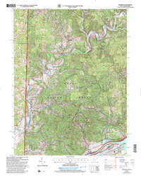
2002 Map of Belmont
USGS Topo · Published 2006About this map
The confluence of the Ohio River and the winding Muskingum River dominates this early 20th-century landscape, where riverfront commerce and rural upland settlements meet along the state line. Wooded ridges and hollows defined by Gaan Ridge and Mt Pagan are largely encompassed by the Wayne National Forest, while the river itself protects unique habitats within the Ohio River Islands National Wildlife Refuge. Small communities like Belmont and Sitka are linked by rural routes such as the Scenic Road and North Country Road.
Find a feature on this map
45 named features on this map. Tap any name to fly to it.
Don’t see what you’re looking for? This feature index may not catch every label — zoom into the map to look around manually.
Map Details
Editions of this 2002 Belmont Map
This is the sole edition of this map. No revisions or reprints were ever made.
Other maps of this area

1903 · Macksburg
USGS Topo · 1:62,500

1904 · Marietta
USGS Topo · 1:62,500

1905 · New Matamoras
USGS Topo · 1:62,500

1905 · Macksburg
USGS Topo · 1:62,500

1906 · Saint Marys
USGS Topo · 1:62,500

1924 · St Marys
USGS Topo · 1:62,500

1924 · New Matamoras
USGS Topo · 1:62,500

1924 · Marietta
USGS Topo · 1:62,500

1926 · New Matamoras
USGS Topo · 1:62,500

1927 · Marietta
USGS Topo · 1:62,500