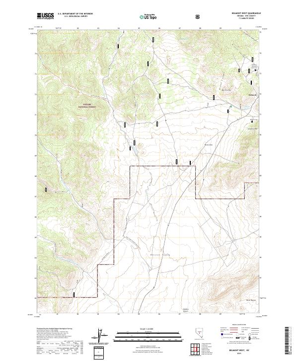
2021 Map of Belmont West
USGS Topo · Published 2021About this map
Belmont stands as the primary focal point of this Nevada landscape, situated where the high desert terrain meets the eastern slopes of the Toiyabe National Forest. This modern survey reveals a region defined by its austere geology and early history, featuring significant sites like the Anderson Shoshone Indian Cem and the Belmont Cem located near Cemetery Hill. The topography is characterized by dramatic cuts such as Snowbird Canyon, Hillen Canyon, and the prominent Devils Gate. Water remains a vital but sparse resource, evidenced by scattered points like Mexican Spring and Hunts Spring. The transport network relies on a mix of rugged routes, including the Belmont Shortcut and forest development roads that traverse the Ralston Valley toward the Ralston Desert. Notable landmarks like Mtn Priscilla and the curiously named Horse Heaven anchor the surrounding wilderness.
Find a feature on this map
32 named features on this map. Tap any name to fly to it.
Don’t see what you’re looking for? This feature index may not catch every label — zoom into the map to look around manually.
Map Details
Editions of this 2021 Belmont West Map
This is the sole edition of this map. No revisions or reprints were ever made.
Other maps of this area

1907 · Tonopah
USGS Topo · 1:250,000

1908 · Tonopah
USGS Topo · 1:250,000

1956 · Tonopah
USGS Topo · 1:250,000

1959 · Tonopah
USGS Topo · 1:250,000

1962 · Tonopah
USGS Topo · 1:250,000

1963 · Baxter Spring
USGS Topo · 1:62,500

1971 · Belmont East
USGS Topo · 1:24,000

1971 · Corcoran Canyon
USGS Topo · 1:24,000

1971 · Manhattan
USGS Topo · 1:24,000

1971 · Belmont West
USGS Topo · 1:24,000