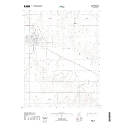
2018 Map of Beloit
USGS Topo · Published 2018About this map
The Solomon River meanders across this North Central Kansas landscape, anchoring the regional geography south of Beloit. This detailed 2018 survey documents the city's grid-based expansion, showcasing a transition from urban streets like W Main St and N Lincoln Ave to the vast agricultural sections of Mitchell County. To the east, the small settlement of Gilbert sits near the headwaters of Plum Cr, while the river valley below is defined by intricate drainage patterns from Leban Cr and Marshall Cr. For genealogists and local historians, the map serves as a vital record of significant community landmarks including Saint Johns Cem, Elmwood Cem, and the more isolated Smith Cem to the east. The layout reveals the essential relationship between the early 20th-century town structure and the enduring natural waterways that shaped Mitchell County's development.
Find a feature on this map
66 named features on this map. Tap any name to fly to it.
Don’t see what you’re looking for? This feature index may not catch every label — zoom into the map to look around manually.
Map Details
Editions of this 2018 Beloit Map
This is the sole edition of this map. No revisions or reprints were ever made.
Other maps of this area

1892 · Concordia
USGS Topo · 1:125,000

1892 · Minneapolis
USGS Topo · 1:125,000

1894 · Mankato
USGS Topo · 1:125,000

1894 · Beloit
USGS Topo · 1:125,000

1952 · Glasco SW
USGS Topo · 1:24,000

1953 · Solomon Rapids
USGS Topo · 1:24,000

1953 · Simpson
USGS Topo · 1:24,000

1953 · Beloit
USGS Topo · 1:24,000

1955 · Manhattan
USGS Topo · 1:250,000

1955 · Beloit
USGS Topo · 1:250,000