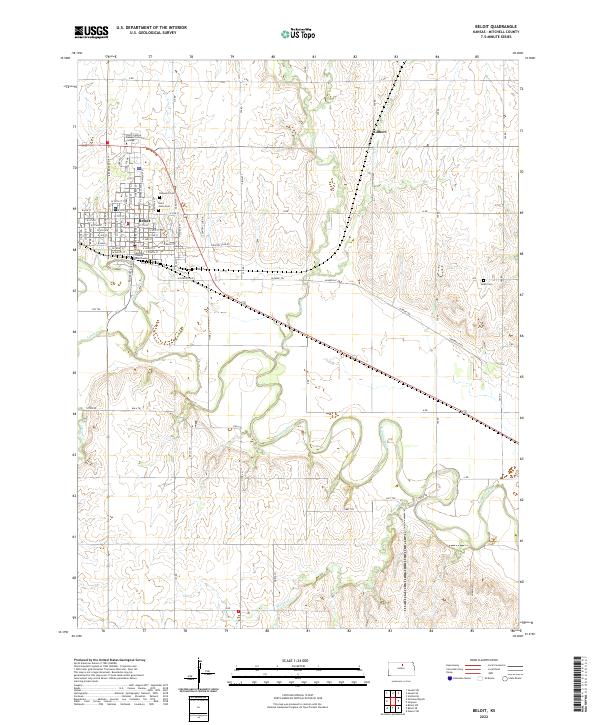
2022 Map of Beloit
USGS Topo · Published 2022About this map
Beloit serves as the focal point of this 2022 survey, situated along the winding course of the Solomon River. The town's civic heart is anchored by the Mitchell County Courthouse, surrounded by a dense grid of residential streets including W Main St and W Court St. Educational and commemorative sites are prominent on the landscape, from the North Central Kansas Technical College to local burial grounds such as Elmwood Cem and Saint Johns Cem.
Find a feature on this map
69 named features on this map. Tap any name to fly to it.
Don’t see what you’re looking for? This feature index may not catch every label — zoom into the map to look around manually.
Map Details
Editions of this 2022 Beloit Map
This is the sole edition of this map. No revisions or reprints were ever made.
Other maps of this area

1892 · Concordia
USGS Topo · 1:125,000

1892 · Minneapolis
USGS Topo · 1:125,000

1894 · Mankato
USGS Topo · 1:125,000

1894 · Beloit
USGS Topo · 1:125,000

1952 · Glasco SW
USGS Topo · 1:24,000

1953 · Solomon Rapids
USGS Topo · 1:24,000

1953 · Simpson
USGS Topo · 1:24,000

1953 · Beloit
USGS Topo · 1:24,000

1955 · Manhattan
USGS Topo · 1:250,000

1955 · Beloit
USGS Topo · 1:250,000