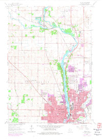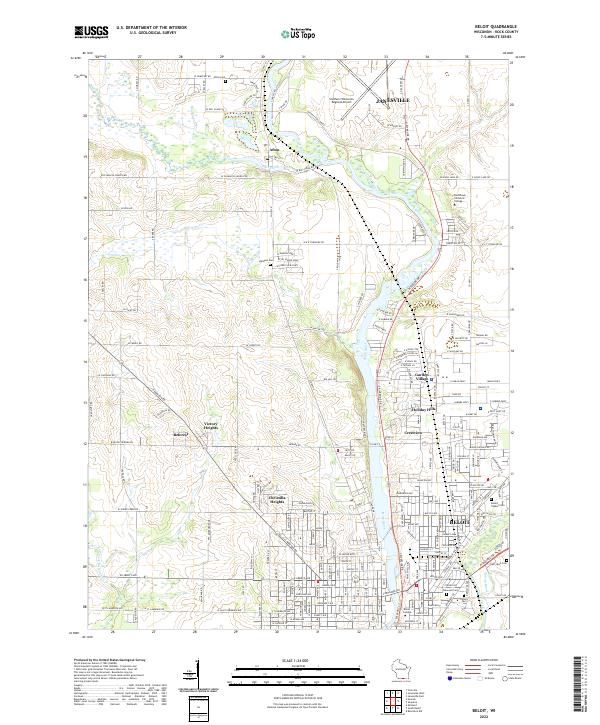
2022 Map of Beloit
USGS Topo · Published 2022About this map
The Rock River corridor anchors this modern survey of Rock County, where the industrial and educational legacy of Beloit meets the southern outskirts of Janesville. The map illustrates a dense network of suburban developments and historical neighborhoods, including Christilla Heights, Crestview, and Garden Village, showcasing the continuous growth along the river valley. To the south, the campus of Beloit College stands near several significant burial grounds such as Oakwood Cem and Calvary Cem, while the northern portion is dominated by the Southern Wisconsin Regional Airport and Blackhawk Technical College. The landscape is characterized by the confluence of Turtle Creek and Spring Brook with the main river, a geography that historically dictated the placement of early settlements like Afton.
Find a feature on this map
51 named features on this map. Tap any name to fly to it.
Don’t see what you’re looking for? This feature index may not catch every label — zoom into the map to look around manually.
Map Details
Editions of this 2022 Beloit Map
This is the sole edition of this map. No revisions or reprints were ever made.