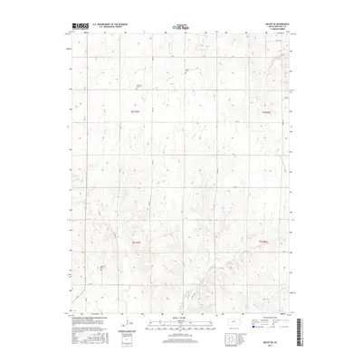
2015 Map of Beloit SE
USGS Topo · Published 2015About this map
Saltville Cem, Shiloh Cem, and New Hope Cem anchor the rolling landscape of Mitchell County in this modern survey. The map records a grid of rural roads, including Victoria Ln and Victory Ln, which navigate the drainages of several regional waterways. This agricultural terrain is defined by the branching paths of Marshall Cr, Fourth Cr, and Fifth Cr, which flow toward the southeastern corner near W Br Third Cr. The survey provides a clear view of land divisions and section lines across townships T8S R7W and T8S R6W, illustrating how local roads like Nelly Trl and O Rd follow the traditional surveyor's grid while the creek beds meander independently through the Kansas plains.
Find a feature on this map
25 named features on this map. Tap any name to fly to it.
Don’t see what you’re looking for? This feature index may not catch every label — zoom into the map to look around manually.
Map Details
Editions of this 2015 Beloit SE Map
This is the sole edition of this map. No revisions or reprints were ever made.
Other maps of this area

1892 · Minneapolis
USGS Topo · 1:125,000

1894 · Beloit
USGS Topo · 1:125,000

1952 · Glasco SW
USGS Topo · 1:24,000

1953 · Solomon Rapids
USGS Topo · 1:24,000

1953 · Simpson
USGS Topo · 1:24,000

1953 · Beloit
USGS Topo · 1:24,000

1955 · Manhattan
USGS Topo · 1:250,000

1955 · Beloit
USGS Topo · 1:250,000

1956 · Manhattan
USGS Topo · 1:250,000

1957 · Manhattan
USGS Topo · 1:250,000