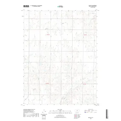
2018 Map of Beloit SE
USGS Topo · Published 2018About this map
Saltville Cem and other rural burial grounds sit among the undulating agricultural divides of Mitchell County, where the headwaters of the Solomon River basin have carved a network of draws and creek beds. This high-plains landscape is defined by the steady drainages of Marshall Cr, Fifth Cr, and Fourth Cr, which dictate the placement of farmstead access roads. The township grid is well-established by a system of section-line roads like S RD and 340 RD, while more idiosyncratic paths such as Nelly Trl and Victory Ln follow the natural contours of the land. For genealogists and local historians, the presence of New Hope Cem and Shiloh Cem provides specific points of interest for tracing early families in this corner of Kansas, where the survey lines of t8s r7w and t9s r7w meet.
Find a feature on this map
29 named features on this map. Tap any name to fly to it.
Don’t see what you’re looking for? This feature index may not catch every label — zoom into the map to look around manually.
Map Details
Editions of this 2018 Beloit SE Map
This is the sole edition of this map. No revisions or reprints were ever made.
Other maps of this area

1892 · Minneapolis
USGS Topo · 1:125,000

1894 · Beloit
USGS Topo · 1:125,000

1952 · Glasco SW
USGS Topo · 1:24,000

1953 · Solomon Rapids
USGS Topo · 1:24,000

1953 · Simpson
USGS Topo · 1:24,000

1953 · Beloit
USGS Topo · 1:24,000

1955 · Manhattan
USGS Topo · 1:250,000

1955 · Beloit
USGS Topo · 1:250,000

1956 · Manhattan
USGS Topo · 1:250,000

1957 · Manhattan
USGS Topo · 1:250,000