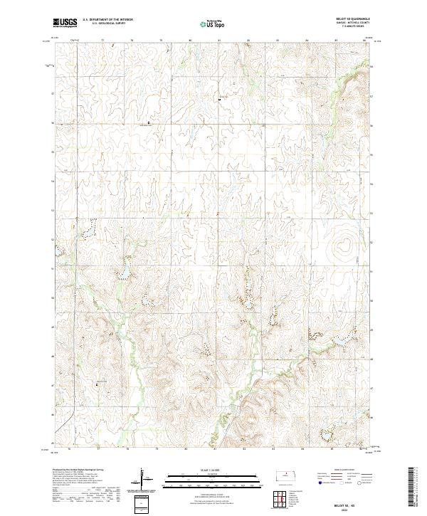
2022 Map of Beloit SE
USGS Topo · Published 2022About this map
Mitchell County cemeteries and the branching headwaters of the Solomon River basin define this central Kansas landscape. The survey documents three distinct burial grounds—Saltville Cem in the southwest, New Hope Cem on the northern plains, and Shiloh Cem further east—each serving as a landmark for the rural homesteads that once populated these sections. These sites are tied together by a strict section-line road network, including thoroughfares such as Victory Ln, Hyde Ln, and Nelly Trl.
Find a feature on this map
30 named features on this map. Tap any name to fly to it.
Don’t see what you’re looking for? This feature index may not catch every label — zoom into the map to look around manually.
Map Details
Editions of this 2022 Beloit SE Map
This is the sole edition of this map. No revisions or reprints were ever made.
Other maps of this area

1892 · Minneapolis
USGS Topo · 1:125,000

1894 · Beloit
USGS Topo · 1:125,000

1952 · Glasco SW
USGS Topo · 1:24,000

1953 · Solomon Rapids
USGS Topo · 1:24,000

1953 · Simpson
USGS Topo · 1:24,000

1953 · Beloit
USGS Topo · 1:24,000

1955 · Manhattan
USGS Topo · 1:250,000

1955 · Beloit
USGS Topo · 1:250,000

1956 · Manhattan
USGS Topo · 1:250,000

1957 · Manhattan
USGS Topo · 1:250,000