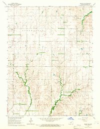
1964 Map of Beloit SE
USGS Topo · Published 1966About this map
Saltville sits at the intersection of several local drainage systems in rural Mitchell County, reflecting the agricultural and topographical character of the mid-1960s Kansas plains. The landscape is defined by the wandering paths of Fourth Creek, Fifth Creek, and West Branch Third Creek, which carve deep contours into the upland sections of Bloomfield, Logan, Salt Creek, and Eureka townships. This 1964 survey captures the community infrastructure of the era, from the educational center at Laban Sch to spiritual and commemorative sites like Green Mound Ch, New Hope Cem, and Shiloh Cem. The prevalence of various Quarry sites and larger Quarries distributed across the ridges suggests a localized extractive industry that utilized the region's natural stone outcrops alongside its traditional farming economy.
Find a feature on this map
17 named features on this map. Tap any name to fly to it.
Don’t see what you’re looking for? This feature index may not catch every label — zoom into the map to look around manually.
Map Details
Editions of this 1964 Beloit SE Map
This is the sole edition of this map. No revisions or reprints were ever made.
Other maps of this area

1892 · Minneapolis
USGS Topo · 1:125,000

1894 · Beloit
USGS Topo · 1:125,000

1952 · Glasco SW
USGS Topo · 1:24,000

1953 · Solomon Rapids
USGS Topo · 1:24,000

1953 · Simpson
USGS Topo · 1:24,000

1953 · Beloit
USGS Topo · 1:24,000

1955 · Manhattan
USGS Topo · 1:250,000

1955 · Beloit
USGS Topo · 1:250,000

1956 · Manhattan
USGS Topo · 1:250,000

1957 · Manhattan
USGS Topo · 1:250,000