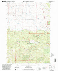
1999 Map of Belshaw Meadows
USGS Topo · Published 2002About this map
Beech Creek serves as a small point of settlement in this high-altitude section of Grant County, where the high desert meets the forested slopes of the Blue Mountains. Revision work by the U.S. Department of Agriculture and the Forest Service in the late 1990s highlights the complex boundary between private ranch lands and the sprawling timber reaches of the national forest. The topography is defined by the drainage of Wiley Creek, which cuts through the northern meadows before the terrain drops into more complex canyon systems. This period of the survey reflects the area's ongoing dual identity as both a productive grazing region and a protected timber resource during a time of evolving federal land management practices.
Find a feature on this map
2 named features on this map. Tap any name to fly to it.
Don’t see what you’re looking for? This feature index may not catch every label — zoom into the map to look around manually.
Map Details
Editions of this 1999 Belshaw Meadows Map
This is the sole edition of this map. No revisions or reprints were ever made.
Other maps of this area

1940 · Mount Vernon
USGS Topo · 1:62,500

1940 · Aldrich Mtn.
USGS Topo · 1:62,500

1943 · Aldrich Mtn.
USGS Topo · 1:62,500

1943 · Mount Vernon
USGS Topo · 1:62,500

1949 · Long Creek
USGS Topo · 1:62,500

1951 · Long Creek
USGS Topo · 1:62,500

1951 · Courtrock
USGS Topo · 1:62,500

1955 · Canyon City
USGS Topo · 1:250,000

1959 · Canyon City
USGS Topo · 1:250,000
1972 · Mount Vernon
USGS Topo · 1:24,000