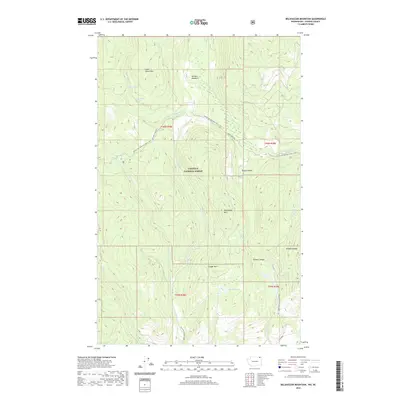
2020 Map of Belshazzar Mountain
USGS Topo · Published 2020About this map
Colville National Forest dominates this section of Stevens County, where the high ridges of the Selkirk Mountains define a landscape of deep canyons and seasonal water sources. The Pacific NW National Scenic Trail winds through the northern half of the quadrangle, crossing the slopes between Lead Pencil Mtn and Belshazzar Mtn. This network of drainage and elevation is anchored by Big Sheep Cr and the various forks of Crown Cr, which provide the primary hydrological structure for the area. Smaller landmarks like Zodiac Spring and Lead Pencil Spring suggest the importance of specific water points in this upland environment. The presence of Bennett Meadow and Sleepy Hollow provides a distinct contrast to the surrounding peaks, indicating rare stretches of level ground amidst the steep terrain of Cougar Mtn and Pepoon Canyon.
Find a feature on this map
31 named features on this map. Tap any name to fly to it.
Don’t see what you’re looking for? This feature index may not catch every label — zoom into the map to look around manually.
Map Details
Editions of this 2020 Belshazzar Mountain Map
This is the sole edition of this map. No revisions or reprints were ever made.
Other maps of this area

1929 · Colville
USGS Topo · 1:125,000

1933 · Colville
USGS Topo · 1:125,000

1936 · Marcus
USGS Topo · 1:96,000

1942 · Marcus
USGS Topo · 1:125,000

1948 · Orient
USGS Topo · 1:62,500

1951 · Orient
USGS Topo · 1:62,500

1954 · Okanogan
USGS Topo · 1:250,000

1958 · Okanogan
USGS Topo · 1:250,000

1958 · Sandpoint
USGS Topo · 1:250,000

1963 · Sandpoint
USGS Topo · 1:250,000