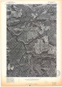
1975 Map of Belt SE
USGS Topo · Published 1975About this map
Otter Creek carves a deep meandering path through the high plains of Cascade County in this mid-1970s orthophoto. The settlement of Blythe sits at the junction of several drainage systems, reflecting the traditional pattern of locating central ranching hubs near reliable water and natural travel corridors. The imagery captures a landscape of intense topographic contrast, where the smooth surfaces of agricultural fields meet the intricate, eroded coulees and breaks of the Cora Creek watershed. This 1975 advance print illustrates the transition in mapping technology, using aerial photography to document the precise layout of field borders and road networks across the high Montana prairie before more modern development altered the ranching footprint.
Find a feature on this map
3 named features on this map. Tap any name to fly to it.
Don’t see what you’re looking for? This feature index may not catch every label — zoom into the map to look around manually.
Map Details
Editions of this 1975 Belt SE Map
This is the sole edition of this map. No revisions or reprints were ever made.
Other maps of this area

1890 · Fort Benton
USGS Topo · 1:250,000

1892 · Fort Benton
USGS Topo · 1:250,000

1897 · Fort Benton
USGS Topo · 1:250,000

1954 · Great Falls
USGS Topo · 1:250,000

1956 · Belt
USGS Topo · 1:62,500

1957 · Great Falls
USGS Topo · 1:250,000
1961 · Limestone Butte
USGS Topo · 1:24,000

1961 · Barker
USGS Topo · 1:62,500
1967 · Monarch NE
USGS Topo · 1:24,000
1967 · Riceville
USGS Topo · 1:24,000