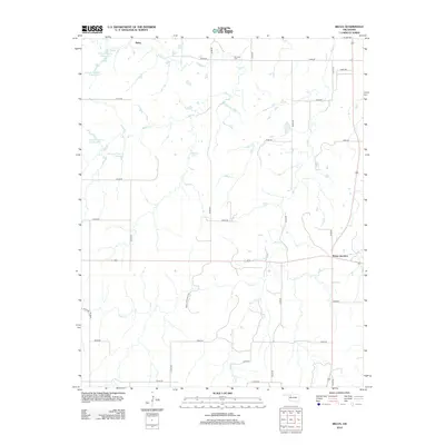
2012 Map of Belva
USGS Topo · Published 2012About this map
Belva and the surrounding agricultural lands of Woodward County are defined by a network of seasonal creeks and family-named reservoirs in this early 21st-century survey. The landscape is etched by the drainage of Cuddy Cr, West Cr, and Main Cr, which flow through a grid of rural section roads. For those researching local heritage, the W Creek Cem sits in the northern reaches, while the intersection at Bouse Junction marks a key point of transit across the southern plains. The prevalence of private water management is evident in the several reservoirs, such as the Debock Number 1 Reservoir and Johnson Number 1 Reservoir, suggesting a landscape focused on ranching and water conservation. White Law Ranch Rd and other local routes provide access to these remote parcels, preserving the spatial layout of Northwest Oklahoma's rural communities.
Find a feature on this map
34 named features on this map. Tap any name to fly to it.
Don’t see what you’re looking for? This feature index may not catch every label — zoom into the map to look around manually.
Map Details
Editions of this 2012 Belva Map
This is the sole edition of this map. No revisions or reprints were ever made.
Other maps of this area

1955 · Woodward
USGS Topo · 1:250,000

1958 · Woodward
USGS Topo · 1:250,000

1969 · Mooreland SE
USGS Topo · 1:24,000

1969 · Phroso
USGS Topo · 1:24,000

1969 · Belva
USGS Topo · 1:24,000

1969 · Quinlan
USGS Topo · 1:24,000

1969 · Waynoka East
USGS Topo · 1:24,000

1969 · Cedardale
USGS Topo · 1:24,000

1969 · Togo
USGS Topo · 1:24,000

1969 · Waynoka West
USGS Topo · 1:24,000