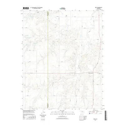
2016 Map of Belva
USGS Topo · Published 2016About this map
Belva and the surrounding ranchlands of the Woodward-Major county line are defined by a complex network of ephemeral drainage and livestock water management. The terrain is deeply incised by the headwaters of Main Cr, Ewers Cr, and West Cr, which are punctuated by numerous private water sources such as Johnson Lake and the Debock Number 1 Reservoir. This 2016 survey illustrates the modern rural infrastructure of the region, where a grid of section roads like e0400 RD and White Law Ranch Rd provides access to the canyon-riven landscape. Near the crossroads of Bouse Junction, the map captures the sparse settlement pattern typical of the Oklahoma northwestern plains, including the solitary West Creek Cem. The density of named reservoirs like the Kee Number 3 Reservoir highlights the critical importance of water storage in this cattle-ranching environment.
Find a feature on this map
25 named features on this map. Tap any name to fly to it.
Don’t see what you’re looking for? This feature index may not catch every label — zoom into the map to look around manually.
Map Details
Editions of this 2016 Belva Map
This is the sole edition of this map. No revisions or reprints were ever made.
Other maps of this area

1955 · Woodward
USGS Topo · 1:250,000

1958 · Woodward
USGS Topo · 1:250,000

1969 · Mooreland SE
USGS Topo · 1:24,000

1969 · Phroso
USGS Topo · 1:24,000

1969 · Belva
USGS Topo · 1:24,000

1969 · Quinlan
USGS Topo · 1:24,000

1969 · Waynoka East
USGS Topo · 1:24,000

1969 · Cedardale
USGS Topo · 1:24,000

1969 · Togo
USGS Topo · 1:24,000

1969 · Waynoka West
USGS Topo · 1:24,000