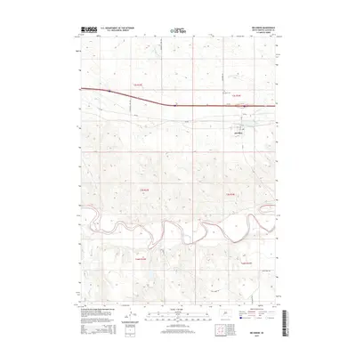
2015 Map of Belvidere
USGS Topo · Published 2015About this map
Belvidere sits at a geographic crossroads in South Dakota, where the transport corridor of Interstate 90 and SD-248 meets the winding valley of the White River. This 2015 survey illustrates a landscape defined by sharp topographical transitions, from the high northern plains drained by W Fork Brave Bull Cr to the intricate, eroded drainage patterns that feed into the White River in the south. The town site itself is small and functional, organized around streets like A St and E St, while the nearby Belvidere Cem serves as a significant local landmark for genealogical research. The map captures the reliance on a few primary arteries, such as Belvidere Rd and Community Well Rd, to navigate a territory where deep creek beds like Deep Cr and Plum Cr carve through the section lines.
Find a feature on this map
25 named features on this map. Tap any name to fly to it.
Don’t see what you’re looking for? This feature index may not catch every label — zoom into the map to look around manually.
Map Details
Editions of this 2015 Belvidere Map
This is the sole edition of this map. No revisions or reprints were ever made.
Other maps of this area

1951 · Pass Creek NW
USGS Topo · 1:24,000

1951 · Stamford SW
USGS Topo · 1:24,000

1951 · Belvidere
USGS Topo · 1:24,000

1951 · Belvidere SW
USGS Topo · 1:24,000

1951 · Cedar Butte NW
USGS Topo · 1:24,000

1951 · Pass Creek NE
USGS Topo · 1:24,000

1953 · Belvidere NE
USGS Topo · 1:24,000

1954 · Belvidere NW
USGS Topo · 1:24,000

1955 · Martin
USGS Topo · 1:250,000

1958 · Martin
USGS Topo · 1:250,000