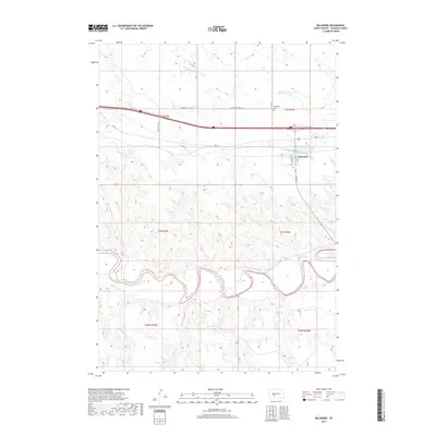
2017 Map of Belvidere
USGS Topo · Published 2017About this map
The town of Belvidere serves as the focal point of this Jackson County survey, situated just south of the modern Interstate 90. The town's grid is clearly defined by Main St, 1st St, and 2nd Ave, while the Belvidere Cem sits north of the central settlement near Community Well Rd. This area of the South Dakota prairie is defined by the winding course of the White River, which snakes across the southern portion of the quadrangle. A network of drainages including W Fork Brave Bull Cr, Deep Cr, and Red Stone Cr feed into the river system, illustrating the natural watershed that dictated early ranching and transit routes. The presence of Hwy 16 running parallel to the interstate reflects the historical evolution of cross-state travel before the completion of the modern highway system.
Find a feature on this map
24 named features on this map. Tap any name to fly to it.
Don’t see what you’re looking for? This feature index may not catch every label — zoom into the map to look around manually.
Map Details
Editions of this 2017 Belvidere Map
This is the sole edition of this map. No revisions or reprints were ever made.
Other maps of this area

1951 · Pass Creek NW
USGS Topo · 1:24,000

1951 · Stamford SW
USGS Topo · 1:24,000

1951 · Belvidere
USGS Topo · 1:24,000

1951 · Belvidere SW
USGS Topo · 1:24,000

1951 · Cedar Butte NW
USGS Topo · 1:24,000

1951 · Pass Creek NE
USGS Topo · 1:24,000

1953 · Belvidere NE
USGS Topo · 1:24,000

1954 · Belvidere NW
USGS Topo · 1:24,000

1955 · Martin
USGS Topo · 1:250,000

1958 · Martin
USGS Topo · 1:250,000