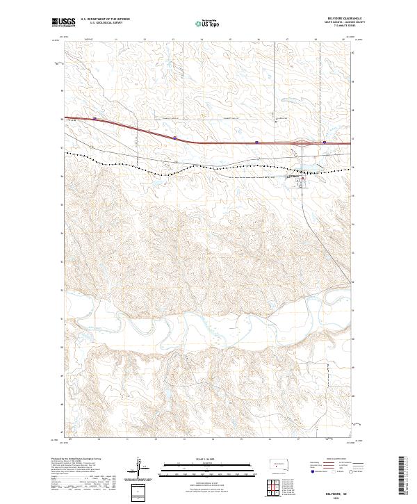
2021 Map of Belvidere
USGS Topo · Published 2021About this map
Belvidere sits at a strategic crossing point in Jackson County, where the infrastructure of the northern plains meets the meandering course of the White River. The settlement is neatly gridded along Main St and 1st St, serving as a central hub for the surrounding ranching and agricultural lands. North of the town, the terrain is defined by the drainage of Brave Bull Cr and its W Fork Brave Bull Cr, while to the south, the landscape becomes increasingly complex as it descends into the river valley. The river itself creates a striking ribbon of riparian geography, joined by tributaries such as Red Stone Cr and Deep Cr. This 2021 survey preserves the modern footprint of the area, including the local Belvidere Cem and the extensive network of rural routes like Community Well Rd that connect the isolated farmsteads across the townships.
Find a feature on this map
20 named features on this map. Tap any name to fly to it.
Don’t see what you’re looking for? This feature index may not catch every label — zoom into the map to look around manually.
Map Details
Editions of this 2021 Belvidere Map
This is the sole edition of this map. No revisions or reprints were ever made.
Other maps of this area

1951 · Pass Creek NW
USGS Topo · 1:24,000

1951 · Stamford SW
USGS Topo · 1:24,000

1951 · Belvidere
USGS Topo · 1:24,000

1951 · Belvidere SW
USGS Topo · 1:24,000

1951 · Cedar Butte NW
USGS Topo · 1:24,000

1951 · Pass Creek NE
USGS Topo · 1:24,000

1953 · Belvidere NE
USGS Topo · 1:24,000

1954 · Belvidere NW
USGS Topo · 1:24,000

1955 · Martin
USGS Topo · 1:250,000

1958 · Martin
USGS Topo · 1:250,000