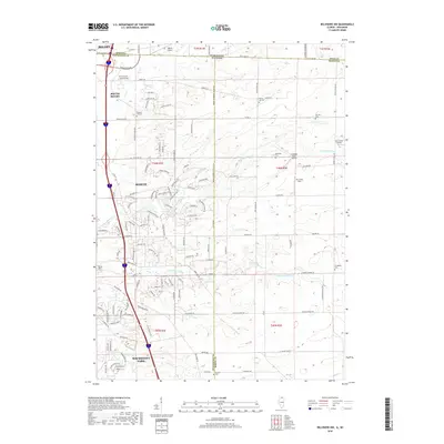
2018 Map of Belvidere NW
USGS Topo · Published 2018About this map
South Beloit and Roscoe anchor this 2018 survey of the Illinois and Wisconsin borderlands, where suburban development meets the agricultural reaches of Winnebago Co. The landscape is defined by the winding paths of N Kinnikinnick Cr and S Kinnikinnick Cr, which carve through the townships. This map is particularly valuable for genealogical research, documenting numerous burial grounds such as Pinnacle Hill Cem, Forest Hill Cem, and the Scottish Cem near the southern border. The transition from industrial corridors near Beloit to the residential expansion of Machesney Park is clearly visible. Aviation history is also represented through several local flight strips, including Beloit Airport and the Compass Rose Airport, illustrating the region's diverse land use as it evolved into the early 21st century.
Find a feature on this map
134 named features on this map. Tap any name to fly to it.
Don’t see what you’re looking for? This feature index may not catch every label — zoom into the map to look around manually.
Map Details
Editions of this 2018 Belvidere NW Map
This is the sole edition of this map. No revisions or reprints were ever made.
Other maps of this area

1891 · Janesville
USGS Topo · 1:62,500

1893 · Janesville
USGS Topo · 1:62,500

1893 · Shopiere
USGS Topo · 1:62,500

1918 · Rockford
USGS Topo · 1:62,500

1918 · Belvidere
USGS Topo · 1:62,500

1938 · Rockford
USGS Topo · 1:62,500

1944 · Belvidere
USGS Topo · 1:62,500

1949 · Rockford
USGS Topo · 1:24,000

1954 · Rockford
USGS Topo · 1:250,000

1955 · Rockford
USGS Topo · 1:250,000