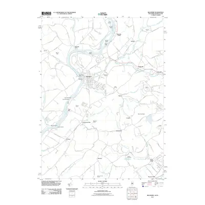
2011 Map of Belvidere
USGS Topo · Published 2011About this map
Belvidere sits at the heart of this landscape where the Pequest River meets the Delaware River, serving as a focal point for settlement and industry. The river corridor is defined by numerous islands and navigation points like Foul Rift Islands and Macks Island, while the legacy of early river crossings is preserved through labels for the Foul Rift Ferry and Hartzells Ferry. Beyond the town center, the map reveals a mosaic of orchards and agricultural sites such as Stoneyfield Orchards and Mackeys Orchard. Local industry and infrastructure are evident in the presence of the Oxford Quarry and aviation sites like Matthews Airport and Johnson Farms Airport. Small rural hamlets including Manunka Chunk, Buttzville, and Brass Castle dot the hillsides, connected by a network of historic roads such as Roxburg Station Rd and Depue Ferry Rd.
Find a feature on this map
146 named features on this map. Tap any name to fly to it.
Don’t see what you’re looking for? This feature index may not catch every label — zoom into the map to look around manually.
Map Details
Editions of this 2011 Belvidere Map
This is the sole edition of this map. No revisions or reprints were ever made.
Other maps of this area

1888 · Hackettstown
USGS Topo · 1:62,500

1890 · Easton
USGS Topo · 1:62,500

1890 · High Bridge
USGS Topo · 1:62,500

1891 · Easton
USGS Topo · 1:62,500

1891 · Delaware Water Gap
USGS Topo · 1:62,500

1893 · Delaware Water Gap
USGS Topo · 1:62,500

1894 · Hackettstown
USGS Topo · 1:62,500

1898 · Hackettstown
USGS Topo · 1:62,500

1898 · High Bridge
USGS Topo · 1:62,500

1900 · Raritan
USGS Topo · 1:125,000