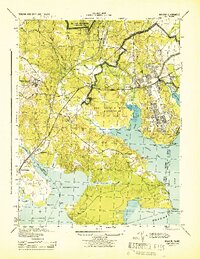
1944 Map of Belvoir
USGS Topo · Published 1944About this map
Fort Belvoir dominates this wartime landscape along the Potomac River, appearing as a major hub of activity during the Second World War. The peninsula of Mason Neck remains largely undeveloped, defined by its intricate shoreline along Pohick Bay and Gunston Cove. This survey reveals a transition from the colonial-era estates like Gunston Hall to modern infrastructure such as the District of Columbia Penal Institute at Lorton. Transportation is anchored by the Richmond Fredericksburg and Potomac RR, which connects the small settlements of Woodbridge and Colchester. Cultural landmarks, including Shiloh Ch and the Fairfax Ruins, provide valuable data for genealogists and local historians tracing the evolution of Fairfax County as it grew from a collection of rural stations like Pohick Sta and Accotink Sta into a critical military and residential corridor.
Find a feature on this map
51 named features on this map. Tap any name to fly to it.
Don’t see what you’re looking for? This feature index may not catch every label — zoom into the map to look around manually.
Map Details
Editions of this 1944 Belvoir Map
This is the sole edition of this map. No revisions or reprints were ever made.
Other maps of this area

1890 · Mt. Vernon
USGS Topo · 1:125,000

1891 · Mt. Vernon
USGS Topo · 1:125,000

1894 · Mt. Vernon
USGS Topo · 1:125,000

1897 · Mt. Vernon
USGS Topo · 1:125,000

1900 · Washington
USGS Topo · 1:62,500

1913 · Indian Head
USGS Topo · 1:62,500

1915 · Fairfax
USGS Topo · 1:62,500

1923 · Indian Head
USGS Topo · 1:48,000

1925 · Indian Head
USGS Topo · 1:62,500

1927 · Quantico
USGS Topo · 1:62,500