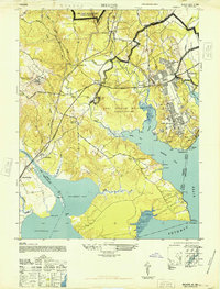
1948 Map of Belvoir
USGS Topo · Published 1948About this map
Fort Belvoir dominates the Potomac shoreline in the late 1940s, its military footprint established across the peninsula between Accotink Bay and Pohick Bay. The map captures a transitional landscape where historic Virginia estates and colonial-era landmarks meet mid-century government expansion. On the northern reaches of Mason Neck, the proximity of Gunston Hall and Shiloh Ch to the burgeoning military reservation highlights the layers of regional history preserved here.
Find a feature on this map
59 named features on this map. Tap any name to fly to it.
Don’t see what you’re looking for? This feature index may not catch every label — zoom into the map to look around manually.
Map Details
Editions of this 1948 Belvoir Map
This is the sole edition of this map. No revisions or reprints were ever made.
Other maps of this area

1890 · Mt. Vernon
USGS Topo · 1:125,000

1891 · Mt. Vernon
USGS Topo · 1:125,000

1894 · Mt. Vernon
USGS Topo · 1:125,000

1897 · Mt. Vernon
USGS Topo · 1:125,000

1900 · Washington
USGS Topo · 1:62,500

1913 · Indian Head
USGS Topo · 1:62,500

1915 · Fairfax
USGS Topo · 1:62,500

1923 · Indian Head
USGS Topo · 1:48,000

1925 · Indian Head
USGS Topo · 1:62,500

1927 · Quantico
USGS Topo · 1:62,500