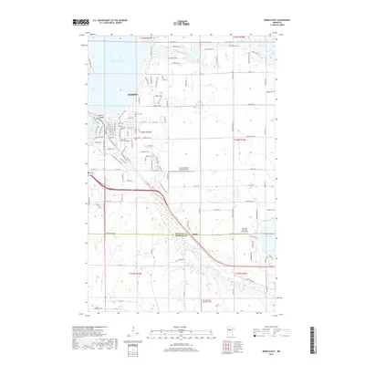
2019 Map of Bemidji East
USGS Topo · Published 2019About this map
The Mississippi River winds through this northern landscape, connecting the expansive waters of Lake Bemidji with Stump Lake as it flows eastward. This 2019 survey documents the eastern reaches of Bemidji, where residential expansion meets the dense wetlands and woods typical of the region. Significant institutional and logistical infrastructure is visible, including the Northwest Technical College campus and the Cloverleaf-East Bemidji Airport.
Find a feature on this map
59 named features on this map. Tap any name to fly to it.
Don’t see what you’re looking for? This feature index may not catch every label — zoom into the map to look around manually.
Map Details
Editions of this 2019 Bemidji East Map
This is the sole edition of this map. No revisions or reprints were ever made.
Other maps of this area

1920 · Buena Vista
USGS Topo · 1:62,500

1954 · Bemidji
USGS Topo · 1:250,000

1957 · Bemidji
USGS Topo · 1:250,000

1958 · Bemidji
USGS Topo · 1:250,000

1968 · Guthrie
USGS Topo · 1:24,000

1968 · Bemidji East
USGS Topo · 1:24,000

1968 · Frontenac Lake
USGS Topo · 1:24,000

1968 · Bemidji West
USGS Topo · 1:24,000

1972 · Peterson Lake
USGS Topo · 1:24,000

1972 · Turtle River Lake
USGS Topo · 1:24,000