
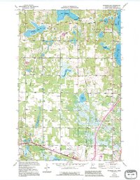
1972 Map of Peterson Lake
USGS Topo · Published 1974About this map
The Old Indian Treaty Boundary cuts across this orthophotomap of Beltrami County, marking a historic line through a landscape dominated by glacial lakes and woodlots. The map detail highlights the northern outskirts of Bemidji during the early 1970s, where the Bemidji Municipal Airport and its Beacon stand near the Soo Line tracks. This era shows a community in transition, with civic landmarks like the Northern Sch and Northern Cem serving the rural township, while leisure culture is represented by the Drive-in Theater along the highway. Extensive wetlands and water bodies such as Turtle Lake, Alice Lake, and Lake Campbell illustrate the complex hydrography of the region, interspersed with several gravel pits that supported local infrastructure growth. Small community hubs like Werner and the Chapel in the Pines provide specific touchpoints for local family historians.
Find a feature on this map
26 named features on this map. Tap any name to fly to it.
Don’t see what you’re looking for? This feature index may not catch every label — zoom into the map to look around manually.
Map Details
Editions of this 1972 Peterson Lake Map
2 editions found
Other maps of this area

1919 · Solway
USGS Topo · 1:62,500

1920 · Buena Vista
USGS Topo · 1:62,500

1943 · Solway
USGS Topo · 1:62,500

1954 · Bemidji
USGS Topo · 1:250,000

1957 · Bemidji
USGS Topo · 1:250,000

1958 · Bemidji
USGS Topo · 1:250,000

1968 · Bemidji East
USGS Topo · 1:24,000

1968 · Bemidji West
USGS Topo · 1:24,000

1972 · White Fish Lake
USGS Topo · 1:24,000
1972 · Grant Lake
USGS Topo · 1:24,000