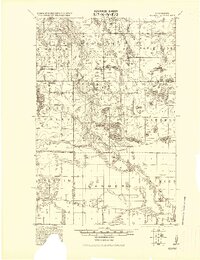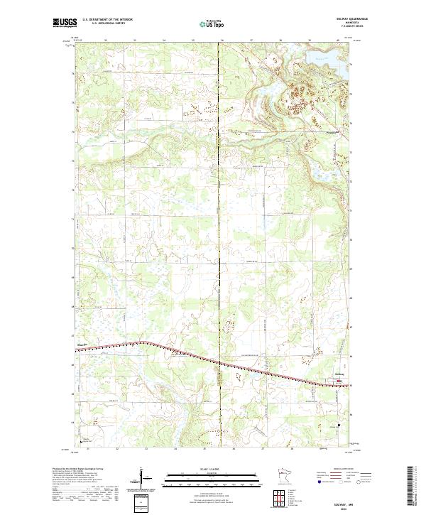
1943 Map of Solway
USGS Topo · Published 1943About this map
The Clearwater River and Mississippi River systems anchor this north-central Minnesota landscape, which was primarily defined by timber and rail transport during the early 20th century. The settlement of Solway and the nearby siding of Scribner sit along the Great Northern Railway corridor, while the Minneapolis St. Paul and Sault Ste. Marie Railway cuts through the western sections near Pinewood. Notable for its vast wetlands and numerous lakes like Buzzle Lake and White Fish L., the map also identifies the Indian Reservation Boundary cutting across the central township. Local industry and infrastructure are represented by the Bagley Dam on the Clearwater, along with several rural schools and churches that served the timbered townships of Buzzle, Lammers, and Eckles.
Find a feature on this map
42 named features on this map. Tap any name to fly to it.
Don’t see what you’re looking for? This feature index may not catch every label — zoom into the map to look around manually.
Map Details
Editions of this 1943 Solway Map
This is the sole edition of this map. No revisions or reprints were ever made.
Historical Maps of Wilton Through Time
8 maps found