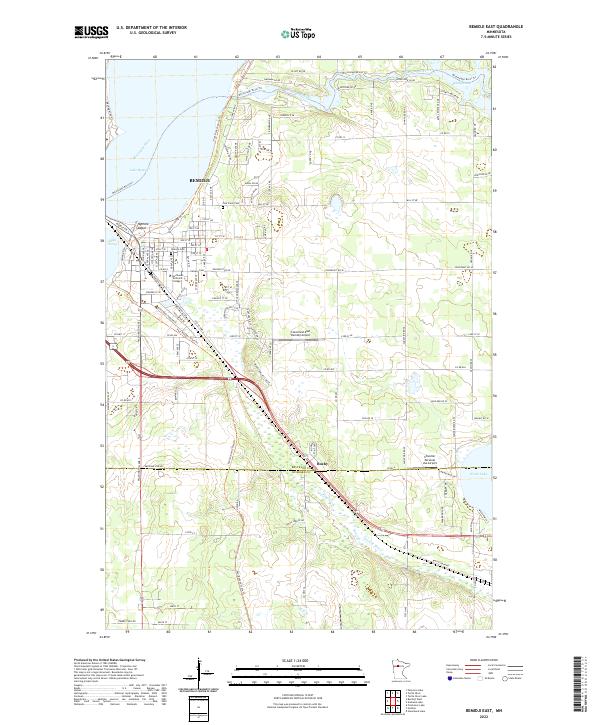
2022 Map of Bemidji East
USGS Topo · Published 2022About this map
Bemidji and its eastern suburbs are captured here at the headwaters of the Mississippi River, where the river flows out of Lake Bemidji and through Stump Lake. The map reveals the dense residential and industrial layout of the Nymore Beach area, featuring several local landmarks including Northwest Technical College and Calvary Cem. To the southeast, the small settlement of Rosby sits near the crossing of the Beltrami Co and Hubbard Co line, illustrating the transition from the city’s urban grid to the more open wetlands and forests of the Northwoods.
Find a feature on this map
68 named features on this map. Tap any name to fly to it.
Don’t see what you’re looking for? This feature index may not catch every label — zoom into the map to look around manually.
Map Details
Editions of this 2022 Bemidji East Map
This is the sole edition of this map. No revisions or reprints were ever made.
Other maps of this area

1920 · Buena Vista
USGS Topo · 1:62,500

1954 · Bemidji
USGS Topo · 1:250,000

1957 · Bemidji
USGS Topo · 1:250,000

1958 · Bemidji
USGS Topo · 1:250,000

1968 · Guthrie
USGS Topo · 1:24,000

1968 · Bemidji East
USGS Topo · 1:24,000

1968 · Frontenac Lake
USGS Topo · 1:24,000

1968 · Bemidji West
USGS Topo · 1:24,000

1972 · Peterson Lake
USGS Topo · 1:24,000

1972 · Turtle River Lake
USGS Topo · 1:24,000