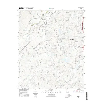
2017 Map of Ben Hill
USGS Topo · Published 2017About this map
The Chattahoochee River carves a natural border through the western portion of this 2017 survey, separating Atlanta from the suburban and industrial developments of the era. This area of Southwest Fulton County is defined by its extensive network of water bodies and reservoirs, such as Niskey Lake, Wrights Lake, and the City of E Point Reservoir. The map illustrates the densification of neighborhoods around historical settlements like Ben Hill, where residential street grids meet major thoroughfares including Camp Creek Pkwy and Fulton Industrial Blvd SW.
Find a feature on this map
277 named features on this map. Tap any name to fly to it.
Don’t see what you’re looking for? This feature index may not catch every label — zoom into the map to look around manually.
Map Details
Editions of this 2017 Ben Hill Map
This is the sole edition of this map. No revisions or reprints were ever made.
Other maps of this area

1888 · Atlanta
USGS Topo · 1:125,000

1890 · Atlanta
USGS Topo · 1:125,000

1891 · Marietta
USGS Topo · 1:125,000

1892 · Atlanta
USGS Topo · 1:125,000

1895 · Atlanta
USGS Topo · 1:125,000

1895 · Marietta
USGS Topo · 1:125,000

1897 · Marietta
USGS Topo · 1:125,000

1901 · Marietta
USGS Topo · 1:125,000

1953 · Atlanta
USGS Topo · 1:250,000

1954 · Palmetto
USGS Topo · 1:24,000